Skip to content

My GIS & Remote Sensing journey

"Not all those who wander are lost"

My GIS & Remote Sensing journey

432 (or Technicolor Hurl)


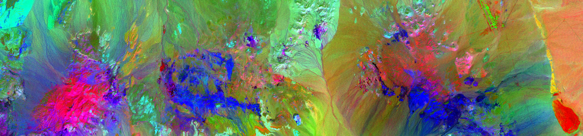
This is bands 4, 3 & 2 from a multi-spectral aerial image of a portion of the Nevada desert. Created in ENVI 5.3 – I think it’s pretty 🙂

Share this:

  • Click to share on Twitter (Opens in new window)
  • Click to share on Facebook (Opens in new window)

Related

Author rgbwebdevPosted on April 2, 2017Tags ENVI, Multispectral, Remote Sensing

Post navigation

Previous Previous post: ENVI SPEAR NDVI
Next Next post: ENVI Image Classification

LinkedIn

Daniel Cardenas
Daniel Cardenas
Web / GIS Developer
View profileLinkedIn

Recent Work

  • 5 Minute Service Area
  • ENVI RGB + Band 7 IR
  • ENVI Image Classification
  • 432 (or Technicolor Hurl)
  • ENVI SPEAR NDVI
  • Mount Shasta, Improved DEM
  • Wildfire Risk Analysis
  • Viewshed Analysis
  • Contour Lines
My GIS & Remote Sensing journey Proudly powered by WordPress