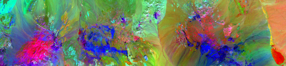
This image shows plant vigor, with darkest green representing healthiest vegetation. Generated from Harris Geospatial’s ENVI 5.3, using their “SPEAR” (Spectral Processing Exploitation and Analysis Resource) tool from a Landsat 8 image of a portion of Contra Costa County, CA.
ENVI SPEAR NDVI
